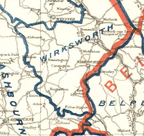
Area around Wirksworth 1885
Updated 28 Jul 2004 |
WIRKSWORTH Parish Records 1600-1900 |
Return to Front Page |
1885 Map |
Here is part of a map, in a: |
Boundaries of proposed Pariamentary Divisions in RED |
Other maps: 1910... 1904... 1897... 1885... 1845... 1835... 1815... 1787... 1746... 1626... 1610 |
Area around Wirksworth 1885 |
|
|
Compiled, formatted, hyperlinked, encoded,
and copyright © 2003,
|
 .
All Rights Reserved.
.
All Rights Reserved.