Updated 11 Aug 2015
|
WIRKSWORTH Parish Records 1600-1900
|
|
This webpage is meant as a "follow-on" from
"The Lees" Auction 1880.
Janice Mather and her husband walked round the
Lees Estate in 2015 with a camera, trying to match
the 1880 Auction text and maps with what could be seen
135 years later. Text and images were received in
the 14 e-mails on this page.
|
Help from Janice Mather |
------------ |
|
Janice Mather and her husband sent me a series of
14+ emails with photos of the Lees area, so full of information
about how the area is today, that I feel compelled to list them
as received. Many thanks to Janice and Neil Mather.
|
Email-14
08/08/2015  2046 hours

I know I'd said all emails were sent, but forgot this bit.
According to the Archeological Assessment Report of 2001 for Wirksworth
said 'buildings along the eastern side of The Dale stood at the foot
of a steep cliff, probably the result of early quarrying, and had very
little land attached. They may have originated as roadside squatter
settlement - in 1649 six cottages are described as encroachments in
The Dale.'
It's interesting that at the bottom of the sales details Lots 12, 13, 14
and a small part of 18 were described as 'in Copyhold of the manor of
Wirksworth with fine small and certain', whilst everything else was
freehold.

Janice
|
Email-13
08/08/2015  1944 hours

Hello John
Thank you for the information on The Lees. All photos sent now, we had
a really interesting time sorting them out - it took me back to my youth!
Just out of interest you might like this; it's flickr so is probably not
useable, but it covers almost the same area as The Lees plan.
https://www.flickr.com/photos/view_from_above/421440440
If any photo needs sorting out, it's no problem.

Thanks

Janice
|
Email-12
08/08/2015  1929 hours
LOTS 12 AND 13
This area of The Dale was discussed in the late 19th Century Sanitary
Inspector’s report. The small cottages of Lot 12 and 13 were, along with
others higher up, in a row along The Dale in the narrow space between
the steeply rising road and the cliff. The houses had their privies and
earth closets in gardens above them or in the really narrow gap between
the house and the cliff face. After heavy rain, there would be seepage
from the privies and earth closets which went down the hill. The Sanitary
Inspector reported it seeping down the internal wall of a cottage, across
the floor and down the internal wall of the next house and so on down the
hill. It was reported to be seeping across the floor of the shop.
The properties might have been demolished so early because this problem
could not easily be solved.
MORE ON the SANITARY INSPECTOR'S REPORT from the late 19th and early
20th Century - if it's of any use.
The Sanitary District was created in the 1870s, and was replaced by
Wirksworth Urban District Council in the 1890s.
Back in the 1980s I read the Wirksworth Sanitary Inspector’s report book
for the late 19th Century, which was in a store room at the local council
offices.
Another report in the Sanitary Inspector’s book of the late 19th Century
was that one or two of the houses in the centre had installed WCs, but
emptied them into old soughs or mine shafts – it wasn’t clear which –
and the waste water then got into the streams.
Another report I remember were fears that some very poor people in the
Wirksworth area were insuring their babies at birth, and then letting
them die to claim the insurance money. (There was the scandal of the
Brixton Baby Farmers of the 1870s.) Whether this was just prejudice against
the very poor, or moral panic after the Brixton Scandal or whether it
actually happened, I don’t know. It seems to me it would be difficult to
get away with it in a small town like Wirksworth.
Later Report from Wirksworth Sanitary Inspector’s book
As late as the 1920s the Sanitary Inspector also reported that the
cottages in Scarthin, in Cromford, had one tap and drain at the bottom of
the hill. (There were a lot more houses in Scarthin then; it has since
been ‘thinned out’.) In the morning people would bring their ‘guzunders’
and commode bowls and empty them into the drain, but it meant that
‘solids’ –we won’t go into the nature of these ‘solids’ - were left resting
on the drain grid. Then people were having to fill their fresh water jugs
and buckets from the tap immediately above the drain!
Unfortunately I can't remember any more - wish I'd photocopied it!
|
Email-11
08/08/2015 1903 hours
Hello John
Here's a couple of photos from Picture the Past and 4 photos were took
this week.
I'll send the information from the late 19th Century Sanitary Inspector
about this area in the next email.
Janice
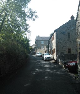
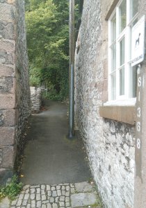
According to the Picture the Past photo, the cottages in Lot 12 and 13 as
well as the row higher up belonging to Mrs Walker had been demolished by
the 1920s.
Lot 12 is on the right with the old rough wall, Lot 13 has the more modern
buttressed wall.
The remains of the buildings near the hoist in Lot 18 are on the left.
Can see how very narrow these houses were, as the Hopton Wood setts along
the kerb are still there.
http://www.picturethepast.org.uk/frontend.php?keywords=Ref_No_increment;
EQUALS;PTPD202263&pos=7&action=zoom&id=111526
NEW PHOTOS
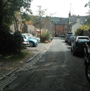
Photo 818 - looking the other way down The Dale
from just below the girls
in the old photo. Lot 12 is behind the metal container, Lot 13 is up from
the tree. Can still see how narrow the cottages were from the Hopton Wood
setts on the old kerb
(Cars are always there, we tried Sunday and mid week!)
1014 - one side of Lot 12. Blue plaster or
limewash from the old backwall
of the cottage can still be seen in 2 places behind the metal, so it looks
as if the cottages were built right against the cliff (as is No 19,21). We
wondered if the window or door shape was access to the garden behind, it
can be seen on the Picture the Past photo.
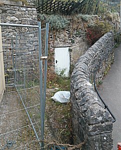
925 - the other side of Lot 12. Perhaps the little
cave behind the door
was used as a cool pantry for the old cottage?
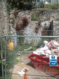
551 - Lot 12 is where the metal container is. Perhaps access to their
garden is by the fence to the right. The gable to 33,31 is on the left.
The remains of some of the buildings at the bottom of Lot 18 are opposite,
the Big Hole is behind the little outhouse.
http://www.picturethepast.org.uk/frontend.php?keywords=Ref_No_increment;
EQUALS;PTPD202251&pos=18&action=zoom&id=111514
Can see remains of the buildings at the bottom of Lot 18. Cottages in this
area were really cramped. On the right is the door to 21 The Dale, which
is built right against the cliff, and a little further up is 31,33 The Dale
with a small backyard between the house and the cliff. In the gap between
the two were 23,25,27 and 29 The Dale, plus an access alley!
|
551
 |
Email-10
08/08/2015 1611 hours
Jack Doxey's in-laws lived in 58 The Dale ('The Tragedy' on The Lees sale
on your site). Think it was one of the houses in the Picture the Past
photo which lasted until 1975 as storage. Though it became so unpleasant
once the stone crusher was installed, suspect it would have become
uninhabitable anyway once the quarry expanded to the top of The Dale and
beyond. In the early 1980s we'd been told stories of, in the past, stones
coming through the roofs of some houses at the top of Greenhill and The Dale.
The Lees would have been between the 2 heaps of gravel.
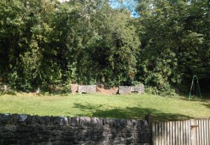
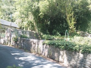
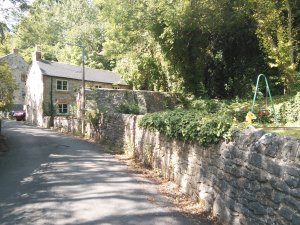
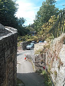
Lot 14, now the playground, is the grass to the left.
58 - one of the houses below the old chapel
http://www.picturethepast.org.uk/frontend.php?keywords=Ref_No_increment;
EQUALS;PTPD202244&pos=25&action=zoom&id=111507
HOUSE NUMBERS
Lower down even numbers are on the left hand side (quarry side) of
The Dale and uneven on the right ('cliff' side), until the houses near
the top
Photo of Mr Wardman's house is 79 The Dale
Lot 14 - cottage with the wall - is 63 The Dale
Lot 15 - rebuilt house is 65
the three houses of Lot 16 - now the single house is 68 The Dale
Lot 17 is on the other side of the steps, but not at all sure the top house
(in the photo of 4 looking upwards from the gable of Lot 14) is actually
the house of Mr Tomlinson as it doesn't seem to quite fit The Lees plan.
|
Email-9
08/08/2015 0030 hours
Lots 15 and 17 have been virtually re-built. Lot 16 is basically the same,
though extended and updated.
Herbert Doxey's in-laws lived in this area.
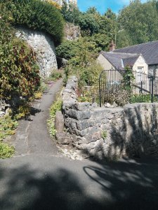
Photo 823 is the gennel that goes through Lot 17 -
it's quite distinctive
as it has a wide entrance with a double set of steps
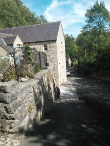
804 is looking down The Dale next to the gable of
Lot 16 towards
Lot 14 - can see the grass of the playground (Lot 15 is out of sight as
The Dale bends)
451 is looking up The Dale - the gable of Lot 14,
then Lot 15, the three
houses of Lot 16 have been made into one house, then there's Lot 17 on
the other side of the steps
This is the area opposite the playground in 1975 - the houses and chapel
had long been converted to storage as they were uninhabitable, but it's
amazing they lasted so long.
http://www.picturethepast.org.uk/frontend.php?keywords=Ref_No_increment;
EQUALS;PTPD202244&pos=25&action=zoom&id=111507
The area is very popular and expensive now!
(Will do Lots 12 and 13 tomorrow)
|
Email-8
08/08/2015 0003 hours

Lot 14 is mostly a children's playground. Only the house on the left at
right angles to road remains - there is a wall, just visible as a thin
line on the map, a little way in front of it. There seem to be a couple
of hearths left under the cliff face, but not sure what they were. Both
the house and play ground are against an ivy covered cliff.
|
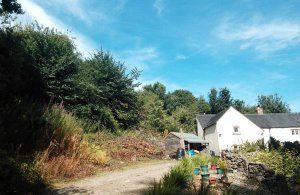
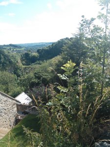
Email-7
07/08/2015 2340 hours
Bit more
The white house (Photo 131), though not part of
the sale, is 'Mr Wardman's' though
it's been extended. Lot 11 is behind the hedge to the left. On the other
side is a gennel that is very overgrown now - it used to be the top way
between The Dale and Greenhill when they were separate, but is barely
used now the two are connected.
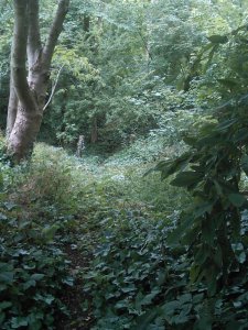
The Big Hole is almost completely filled in and is now a nature reserve
and the other quarries surrounding The Dale and Greenhill have been closed
and are reverting to nature.
There is a fairly new footpath now along the old route of The Dale at the
very top through one of the closed quarries. Photo 628
is taken from there
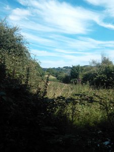
looking back to the very top of Lot 18. The trees on the horizon to the
right are in Lot 5- half way across as half has gone from quarrying- or
the trees are possibly on the far side of 'Mrs Ogden's' field.
Photo 740 is taken from Greenhill from just below
the gennel on the fold-
actually above Lot 17 though it isn't visible (the house on the photo is
a different one). It looks across the nature reserve where the Big Hole
is filled in; think The Lees would be where the trees are.
Can you believe the difference? The Big Hole in 1958 taken from the other
side
http://www.picturethepast.org.uk/frontend.php?keywords=Ref_No_increment;
EQUALS;PTPD202191&pos=1&action=zoom&id=111454
|
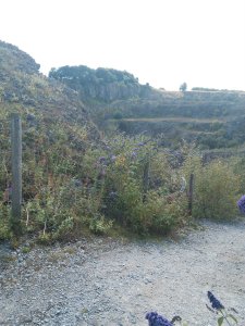
Email-6
07/08/2015 2157 hours
Hello John
Bit more.
The top third of Lot 11 has been cut off by quarrying. The Dale used to
straight on to Dale Farm where it became a footpath, whilst Greenhill used
to go to Middleton. Now Greenhill has been joined to The Dale across the
top part of Lot 11.
The photo 043 peering through the nettles is looking
through the present top
gate of 'Lot 11' at the point where The Dale now ends - roughly next to
the words 'Mrs Abbott' - towards the letter L. The other one (521) is taken from
the present route of Greenhill just off the top of the map, roughly looking
towards the words ' Lot 11'
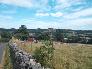
|
043
 |
521
 |
Email-5
06/08/2015 1401 hours
Hello John
Here they are
003 The main gate to the Lees at the junction of the 2 roads (the opposite
side of the road from the corner of Lot 8)
014 The bottom footpath gate to Lot 2 and the trees on the site of Lot 2-
taken from the gennel to Crown Yard and the Market Place, looking up the
hill across Bowling Green Lane. (links to 204 - the wall and picket fence
of the very old building are just to the photographer's right.)
204 Bottom footpath gate to Lot 2 (between words Bowling and Green on map)
is on the left, the gennel down to Crown Yard and the Market Place on the
right - past the gable end of the very old building.
Bowling Green Lane is ahead - the red brick house where the Lane divides
was built in 1883 or 5, on the triangular bit on Lot 2 (with the printed
number 30).
(To get your bearings, the very old building with the picket fence is just
next to the letters G and R on The Lees map, and the back of the property
belonging to 'Mr J Bunting' is visible just beyond the red brick house.)
539 The date stone on the red brick house - it's not clear if it is 1883 or
1885, we couldn't read it very well from the footpath (links to 204)
240 This is looking across the corner of Lot 8, taken from the road to
Middleton Top and Hopton Works, looking south west across the field to the
road from West End to Godfreyhole. (To get your bearings, the 2 old field
barns are to the photographer's right just off the photo. The old main gate
to The Lees is just behind the photographer to the left on the junction of
the two roads).
359 and 452 Pretty sure the circle in Lot 5 on the map is a mine shaft as
this is in the exact place. It just looks a small green hump in a field by
a wall, but it's a typical mine shaft. (Think you've sorted this one,
looking at your webpage.)
406 Not much to see of Lot 3 - just the wall and trees where (the top
gennel of) Bowling Green Lane bends. Photo taken from The Dale.
(On the map of The Lees sale, the bottom gennel is labelled Bowling Green
Lane; these days the TOP gennel (almost opposite the site of Lot 12) has
the street nameplate for Bowling Green Lane, but I don't think it makes
much difference!)
909 The 2 footpath gates from West End to The Lees on the bend where West
End widens a little above Lot 1a. The right hand gate - just the gate post
showing, leads to a fairly modern bungalow. The left hand gate leads upwards
into woodland. There's a stump of an old rusted lamppost in the middle
between the 2 gates. Think the wall will date back to The Lees - it is well
built of good stone.
747 The view up towards the site of The Lees through the left hand footpath
gate off West End, though it is very overgrown now - taken with a zoom.
(mentioned the zoom as the gate is locked and didn't want anyone to think
I'd been wandering!)
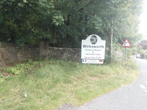
919 a close up of the main gate to The Lees - peering behind the town
sign for Wirksworth. (This links to photo 003)
026,047, 436, sorted
I'll sort out The Dale photos later today or probably tomorrow. I think
2 houses are left which are more or less the same, and there's another
couple which have been substantially re-built.
We had a really interesting time wandering round Wirksworth and fitting
the map to present day buildings. I originally trained as a history and
geography teacher (though it's not what I do now) so this sort of task
was interesting to do! My husband likes photos, old buildings and walking,
so he didn't mind. We had quite a nostalgic time!
Janice
|
047
 |
436
 |
Email-4
05/08/2015 2004 hours
Bit more John

452+359 Pretty sure the circle in Lot 5 on the map is a mine shaft as this is in
the exact place. It just looks a small green hump in a field by a wall,
but it's a typical mine shaft.
436 The 2 old field barns are either side of the remains of the wall - they're
on the map on the boundary between Lots 6 and 8. They are a bit further
up on the other side of the road from The Lees main gates.
240 This is looking across the corner of Lot 8, from the road to Middleton Top
and Hopton Works across the field to the road to Godfreyhole (beyond West
End) - very near the old main gate to The Lees
026 Part of Lot 9 - The barn (now converted to a house) on the roadside in the
bottom corner and part of the field
We took more photos around The Dale, I'll send them tomorrow or Friday.
Hope they're useful.

Janice
|
240
 |
026
 |
Email-3
05/08/2015 1913 hours
406 Not much to see of Lot 3 - just the wall and trees where (the top gennel
of ) Bowling Green Lane bends
539 Lot 2 - date of red brick house built 1883 or 5 on triangular piece of
Lot 2 (with printed number 30 on map)
204 Bottom footpath gate to Lot 2 (between words Bowling and Green on map).
Bowling Green Lane ahead  with red brick house where it divides, gennel
down to Crown Yard and Market Place on the right
014 Bottom gate to Lot 2 taken from gennel to Crown Yard

Janice
|
014
 |
Email-2
05/08/2015  1819 hours

Next one John

003 The main gate to the Lees at the junction of the 2 roads with a close up
(919) behind the Wirksworth sign plus the 2 footpath gates (909) to The Lees -where
West End widens- and the view (747), taken with a zoom, of the view through the
left hand gate.
|
909
 |
Email-1
05/08/2015  1146 hours

Hello John

Just attaching a photo (047) we took of one of the places mentioned in The Lees
auction details to see if it works and you're able to see it OK. (This
photo is of Lot 1a and the bottom entrace to the Lees which also went to
Lot 2.)
I went with my husband for Sunday lunch in Wirksworth and we went for a
nostalgic walk around and took quite a few photos of the 'remains' of the
different Lots - my husband is a better photographer!
Picture the Past has some very interesting photos too of some of the
auction sites on The Dale - just checking that the link for their photo
of Lot 1a works - though it only dates from the 1980s.
http://www.picturethepast.org.uk/frontend.php?keywords=Ref_No_increment;
EQUALS;PTPD103171&pos=83&action=zoom&id=104437
If it all works OK I'll send you the photos and any links to relevant
Picture the Past photos. I'll also resend the information about Lots 12
and 13 and the Sanitary Inspector in an email.
Just one more thing, is it OK for me to print a copy of the plan so I can
mark on where we took the modern day photos, and also where the Picture
the Past photos are? I won't keep it once I've scanned it with the details.

Thank you

Janice
|
047
|
|
014
|
026
|
919
 |
925
 |
Compiled, formatted, hyperlinked, encoded,
and copyright © 2015,
 All Rights Reserved.
|