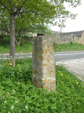
The Guide Stoop, with Sycamore Farm behind.
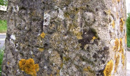
"DARBY 1705"
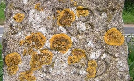
"ASHBOR 1705"
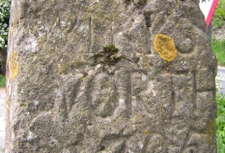
"WIRKS-WORTH 1705
Dates:
Photo taken:
Size:
Source:

Click on photo for enlargement (on CD only)
Have any more information about this photo?
Please e-mail the author on:

Dates: Photo taken: Size: Source: Click on photo for enlargement (on CD only) Have any more information about this photo? Please e-mail the author on:
Hopton Guide Stoop.
Photographs and most of the text supplied by
Flipflopnick.
Many thanks Nick.
The Guide Stoop is on Stainsboro Lane, where it meets the B5035, opposite Sycamore Farm, just East of Hopton.A guide stoop is a stone pillar about 9 feet long with half above ground, and at least town names chiselled on. This Stoop was broken into three pieces by a car running off the road, it was later repaired but is now wrongly aligned. It is the oldest stoop in the Derbyshire Peak District dated 1705. In the UK milestones of various kinds exist. Some belonging to formal series, others not. For example, in 1697 William III passed an Act decreeing that in the more remote parts of the kingdom, where two or more paths intersected, local surveyors were to erect guide stones known as guide stoops showing the way to the nearest market town. |
Note how "Darby" was spelled as it is pronounced, not as it is is spelled today. Have our American cousins got it wrong?